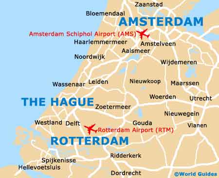
Rotterdam The Hague Airport (RTM)
City Orientation and Maps
(Rotterdam, Netherlands)
With a population of more than 600,000 people, the city of Rotterdam is the second-biggest in the whole of the Netherlands. Located close to the north-western coast, Rotterdam is home to an extremely diverse mixture of architectural styles, including countless modern and attractive buildings. Many of these structures serve as useful reference points, making it difficult to get lost in the city.
Most people travelling from outside of Holland choose to fly into Rotterdam Airport (RTM), which is situated in the north-western suburbs. Further north you will find the tourist hotspot of Amsterdam, which is around 72 km / 45 miles from Rotterdam and can be reached in just over one hour by car.
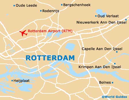
Rotterdam Airport (RTM) Maps: Important City Districts
Located on the western side of Rotterdam, the city's bustling harbour has become the busiest port in Europe and boasts a number of waterfront attractions and nearby restaurants. Much of Rotterdam is divided by the Nieuwe Mass shipping canal, crossed by a number of stylish bridges, including the iconic and eye-catching Erasmusburg bridge, together with several tunnels.
A good way to sightsee and gain your bearings at the same time is to walk along the Nieuwe Maas, which is lined with many modern structures. A number of Rotterdam's train stations are also known for their contemporary architecture, including Blaak Station.
Several noteworthy residential neighbourhoods are now located on the southern side of Rotterdam, just a short distance from the city centre and the Centraal Station. Those looking for the waterfront will find it easy to reach, with a trail passing a series of long ponds. Other areas of interest in Rotterdam include the old town district of Delfshaven to the west, and the main area of commerce to the east, where many prominent local businesses reside.
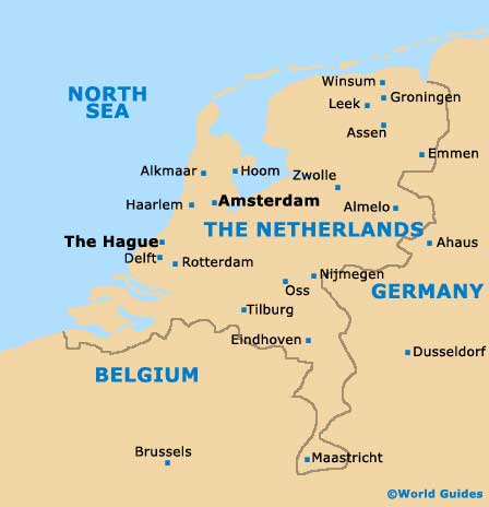
Netherlands Map
Rotterdam Map